
Wildfire Burn Severity Analysis
Evaluate Wildfire Environmental Impact and Assess Burn Severity using Cloud Based Geoprocessing via Earth Engine. Computes NBR and environmental indices with climate context.
Transforming geospatial data into meaningful insights for environmental solutions.
I'm a Geospatial Developer and Environmental Analyst with expertise in geospatial analysis, remote sensing and environmental studies. I combine technical skills with domain knowledge to develop practical solutions that help assess environmental impacts and understand changes across urban and natural environments.
My work spans from building interactive geospatial applications to performing spatial analysis and developing automated workflows using Python and open-source technologies. Through satellite imagery, environmental data, and geospatial tools, I aim to transform complex datasets into accessible insights that support research, environmental monitoring and informed decision-making.
Processing and analysing multispectral satellite imagery for environmental monitoring and land surface assessment.
Assessing vegetation health and environmental change using spectral indices and Earth observation data.
Building scalable workflows using cloud-based geospatial platforms and satellite data archives.
Comparing environmental conditions through time to identify trends, impacts and landscape transformations.
Building interactive tools that make geospatial analysis accessible to researchers and non-technical audiences.
Automating geospatial processing tasks using Python and open-source libraries.
Creating interactive mapping experiences for exploration and communication of spatial data.
Designing and maintaining transparent, reproducible and community-driven geospatial tools.
Evaluating project impacts, modeling environmental vulnerabilities & establishing GIS workflows for temporal ecosystem monitoring.
Evaluating wildfire impact and burn severity using remote sensing and environmental indicators.
Integrating, processing and interpreting precipitation, temperature and environmental datasets and trends.
Delineating watersheds & mapping stream networks through terrain model processing and flow routing algorithms.
Analysing elevation data, slopes and flow accumulation to map hydrological vulnerabilities and flood-prone zones.
Designing clear and informative maps for analysis, communication and decision support.
Transform complex spatial datasets into intuitive visual representations.
Develop interactive interfaces for exploring environmental and geospatial information.
Creating 3D terrain models and visualizations from spatial datasets like DEM & DSM.

Python

Google Earth Engine

QGIS

GeoPandas

Rasterio

Streamlit

Folium

MapBox

Kepler.gl

CSS

HTML

Blender

SQL

DuckDB

Git

GitHub
Evaluate Wildfire Environmental Impact and Assess Burn Severity using Cloud Based Geoprocessing via Earth Engine. Computes NBR and environmental indices with climate context.
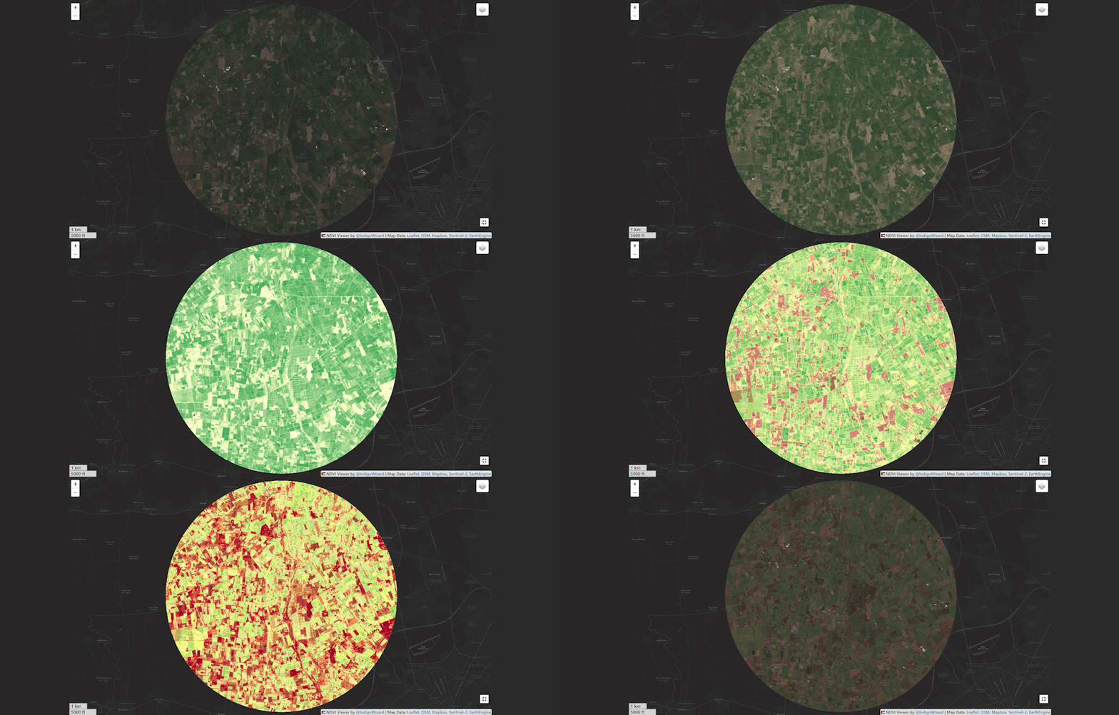
Monitor Vegetation Health by Viewing and Comparing NDVI Values Through Time and Location with Sentinel-2 Satellite Images on The Fly!
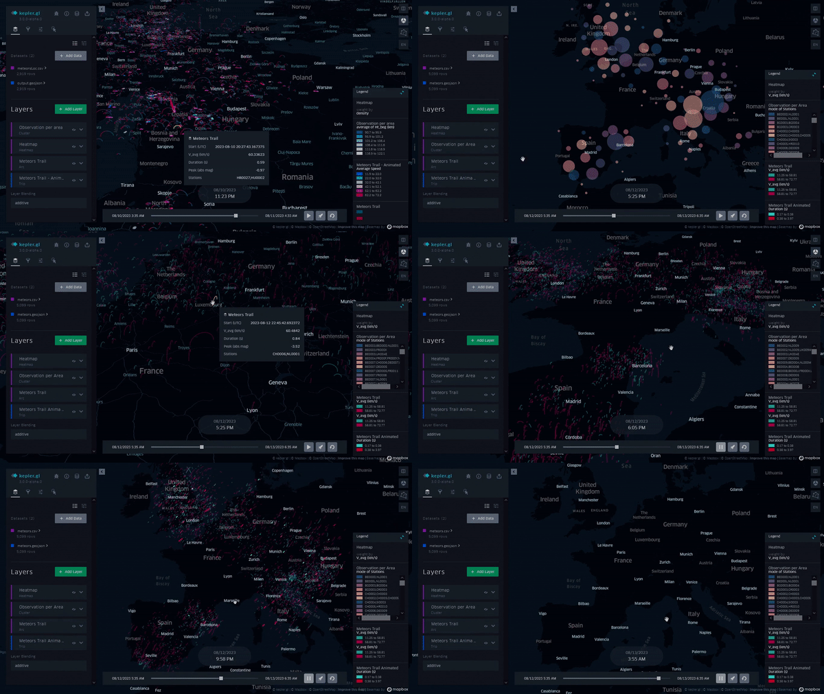
Meteor Shower Data Visualization through Kepler.gl - Interactive exploration of meteorite traveling data across the globe.
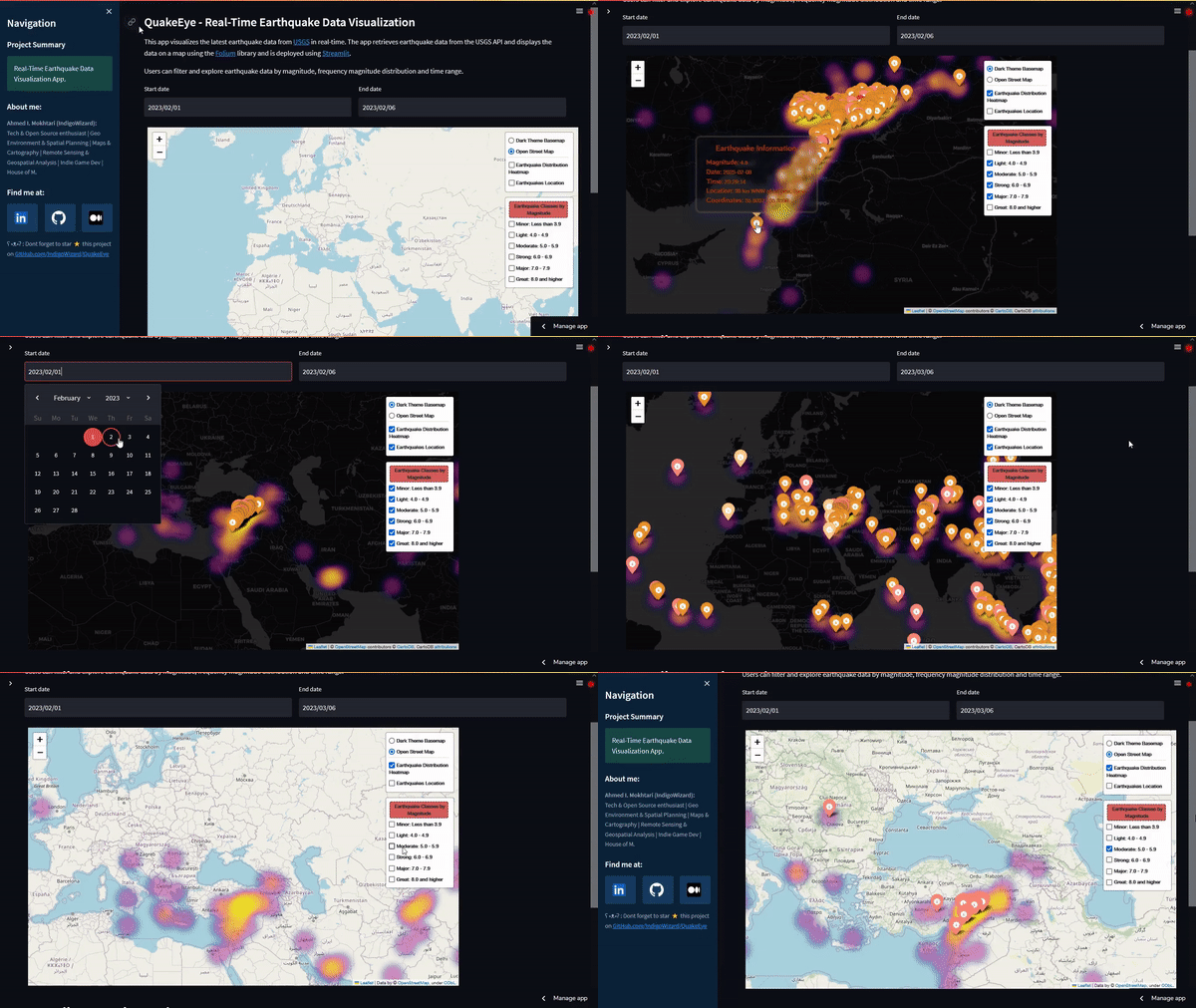
Real-Time Earthquake Data Visualization project built using Folium and Streamlit with USGS API integration for live seismic monitoring.
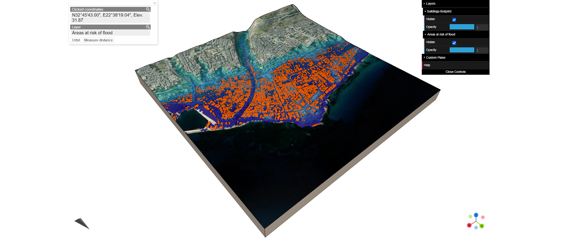
3D flood risk visualization in QGIS for Derna, Libya after Storm Daniel. Showcases flood-prone areas based on elevation analysis.
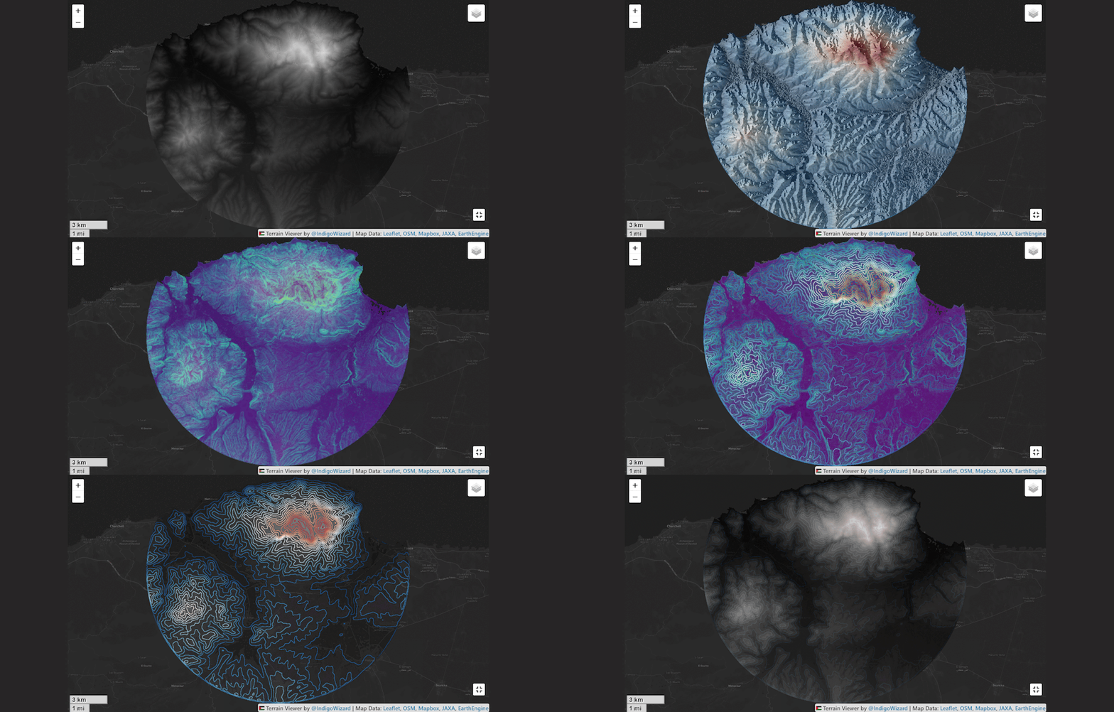
Interactive Web GIS app to visualize terrain information from JAXA's ALOS World 3D Map 30m (AW3D30) dataset using a Digital Surface Model (DSM)
Interested in collaborating on a project or have questions about my work? Fell free to reach out.